Bravik, Ostergotlands, Sweden
|
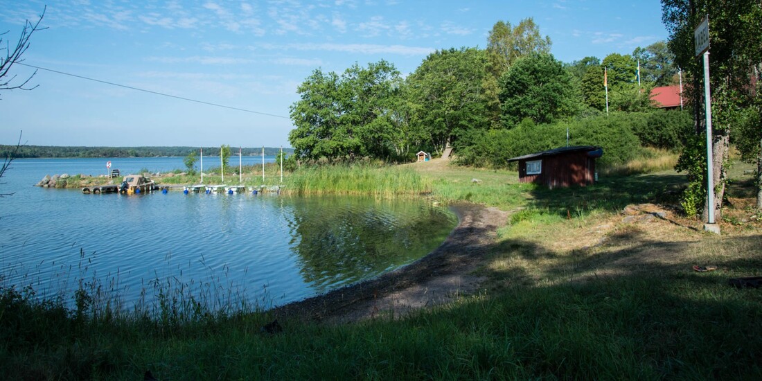
Breviks Lägergård Badplats is a small beach on the grounds of the holiday camp Brevik. It is located on the peninsula Vikbolandet on the northern shore of the long bay Slätbaken near Norrkrog, about 35 kilometres southeast of Norrköping.
|
Breviks Lägergårds Badplats 2018 | Photo: GuidebookSweden (CC BY-SA 4.0)
|
|
Östergötlands Län
The province Östergötlands Län, the northeastern part of southern Sweden, covers the area between the lake Vättern and the Swedish east coast and is the northernmost province of southern Sweden (Götaland) on the east coast of the country. With an area of almost 10,600 square kilometres, Östergötlands Län meets the middle of all Swedish provinces in terms of size. |
Östergötlands Län
|
Östergötlands Län is congruent with the area of the historical landscape of Östergötland. The province borders in the south on the Småland provinces Jönköpings Län and Kalmar Län and in the north on the provinces Örebro Län and Södermanlands Län in Central Sweden (Svealand).
The landscape of Östergötland consists of several completely different landscape types. About 30 kilometres wide, a flat plain with extensive fields and intensive agriculture stretches from west to east along the geographical centre. The provincial capital Linköping is located in the centre of the plain and thus almost exactly in the middle of the province.
To the north and south there are dense forests on rocky mountain ridges. Except for the single, 263 metre high Omberg with its cliffs on the banks of the Vättern, the plain runs westwards to the edge of the lake without major differences in height. To the east, near the coast, the landscape becomes more and more rocky and merges into the archipelago of Östergötland with over 6,000 small and large islands.
The coast is also characterised by a total of three sea bays cut several kilometres deep into the mainland. The largest of them is Bråviken, which reaches the gates of Norrköping with its high rocky shores, followed by Slätbaken, which ends shortly before Söderköping and forms the starting point for the famous Göta Canal.
The province is also very rich in lakes, with some lakes reaching an impressive size. By far the largest lake is the Vättern, which is the second largest lake in Sweden with an area of almost 1,900 square kilometres. It is followed by the 132-square-kilometre Sommen, the Roxen with an area of 95 square kilometres and the 74-square-kilometre Glan.
